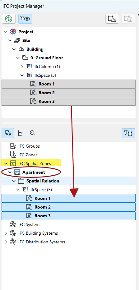
IFC Spatial Zones assignment
The IfcSpatialZone entity is used to group spaces or define specific areas for functional, structural, or organizational purposes, such as thermal zones, lighting zones, or construction zones. Unlike basic groups, the IfcSpatial Zone can have its own distinct 3D shape and placement. (See the description at: buildingsmart.org
This feature is supported by Archicad workflows using IFC4 and IFC4x3.
- Use the Morph or Zone tool to model your spatial elements.
- Classify the elements as e.g. "Spatial Zone." (Create a new Classification if your system does not include such a Classification.)
- Configure your Translator for Export:
- Use the IFC4 or IFC4x3 Schema
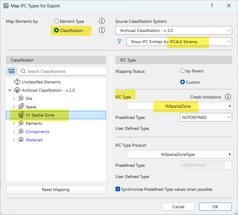
- Open Type Mapping, and "Map IFC Types for Export"
- Map your Spatial Zone classification as IFC Type = IfcSpatialZone
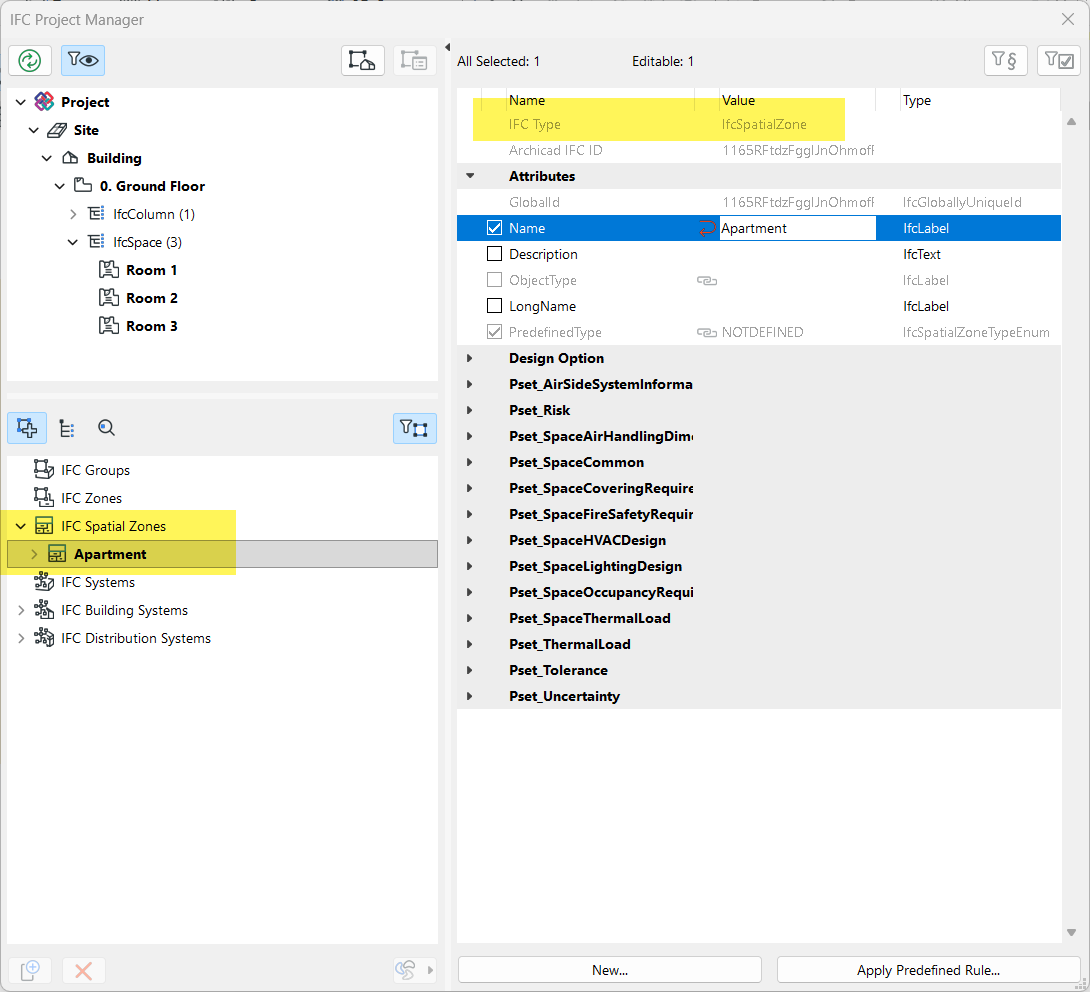
In IFC Project Manager: elements mapped as ifcSpatialZone appear in the IFC Spatial Zone assignment list.
In this example, a zone representing the entire apartment is classified as a Spatial Zone. As
a result, this zone entity appears as an IfcSpatialZone.
Now you can assign the regular zones, or any other elements (e.g. objects, columns), to the newly defined Spatial Zone by dragging them into the Spatial Relation folder.