
Archicad’s Survey Point can be used as common reference point to facilitate coordination of models from different programs.
In some countries, use of a particular reference point is a standard requirement when defining the project.
Survey Point can also be used
•to align the XREF origin (in the Attach Xref Options dialog)
•to align a Hotlink Module (in the Place Hotlink dialog)
•to align the IFC Site location of an exported IFC model (see Define IFC model position by:)
The Survey Point is also integrated into Archicad's workflows with BCF, DXF, DWG, and IFC, which also use the project’s native Survey Point data.
In Teamwork: To edit the Survey Point, first reserve Locations Settings.
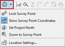
Survey Point Commands in the Standard Toolbar


Show/Hide Survey Point
Click the toggle to display the Survey Point.
By default, the Survey Point is placed at the project origin.
Click and drag to move it.
Lock Survey Point
Use this to keep from accidentally moving or editing it.
Zoom to Survey Point
Zooms to the Survey Point on the Floor Plan.
Show Survey Point Coordinates
Displays the Survey Point's coordinates in the project, to the right of the Survey Point.
The coordinates use the project's Working Units for length dimensions.
To set position data: see Survey Point Symbol and Position.
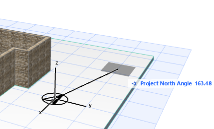
Set Project North
In Floor Plan or the 3D window:
1.Click to display the Project North icon.
2.Move the pointer to set Project North.
The Survey Point’s North Angle coordinate is adjusted accordingly.
Edit Survey Point Coordinates
Do any of the following:
•Left-click the Survey Point and enter coordinates in the appearing Tracker
•Click and drag the Survey Point
•Rotate the Survey Point (see below)
•Use Location Settings (Options > Project Preferences)
Survey Point Symbol and Position
1.Go to the Survey Point panel of Location Settings
•from Options > Project Preferences > Location Settings
•from the context menu of the Project Name in the Navigator
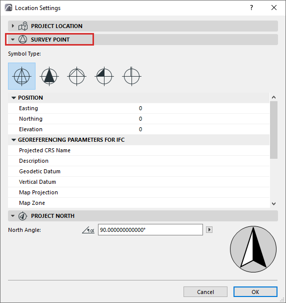
2.Choose a Symbol Type for the project Survey Point
3.Set Position data. Easting, Northing and Elevation data are measured relative to the Project Origin.
Georeferencing
These are a set of location data used in IFC data exchange; they are exported as IFC Properties. They do not affect the Survey Point location in Archicad.
–Export via IFC 2x3: The data are exported as two new IFC Property Sets.
–Export via IFC4: New IFC entities are created: IFC Map Conversion, and IFC Projected CRS.
For more information, see User Guide for Geo-referencing in IFC.
Rotate Survey Point
On the Floor Plan:
1.Hover over the Survey Point to preselect it.
2.From the context menu, click Rotate Survey Point, then rotate on screen
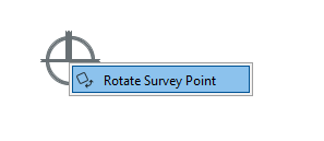
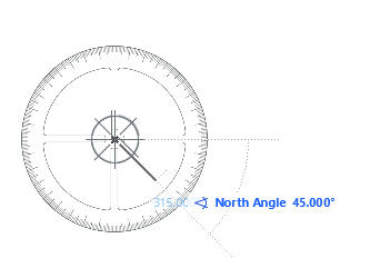
You can also use the regular Edit > Rotate command, or adjust Tracker values.